

Raw Water, Stormwater Retention Ponds, Lakes and Rivers
Raw water storage ponds are used for storage to pull from reservoirs for drinking water. Raw water ponds contain sediment which builds up over time. In order to know the capacity of your ponds it is essential to measure the sediment in your raw water ponds. We measure and map raw water sediment. Our survey equipment is self contained and battery operated and will not contaminate your raw water ponds. To eliminate contamination, our equipment is cleaned and disinfected prior to entering a raw water pond. Once surveyed you will have accurate sediment volumes and 3D sediment thickness maps for each of your raw water ponds. These maps can be used for planning and presenting to council.
Raw Water Ponds


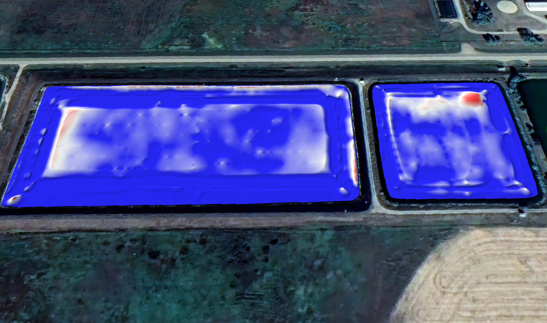
Stormwater retention ponds are used to store and contain excess ground water and runoff. These are also used in emergencies. Therefore, knowing the capacity and contents of your stormwater retention ponds is critical for city and municipal planning. Hydrasurvey’s sediment surveys will provide you with the quantity and composition of sediment as well as 3D sediment maps overlaid onto drone images. These maps and images are perfect tools when planning for maintenance projects. They will highlight which ponds are at capacity and which ponds need to be cleaned or maintained.
Stormwater Retention Ponds


We complete sludge surveys on rivers and lakes, these projects consist of measuring sludge and sediment changes before or after construction projects. By measuring sludge / sediment changes clients can ascertain if the project is completed or remediated as per the project plan.


